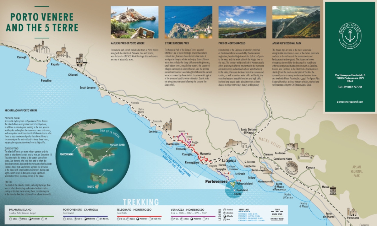
The hiking trails in Portovenere and nearby Cinque Terre allow you to explore and appreciate the territory in a unique way. You listen to nature, observe the local lifestyle off the beaten path, and think about sustainability and health. Hiking also gives you a tremendous amount of pleasure and satisfaction!
While most visitors have heard of Cinque Terre, fewer know about Portovenere and its surprising hiking routes. Following an excursion between these destinations, American trek guide Pall explained on his TrekGuyd blog:
Portovenere remained the most popular hike. The feedback from young and old seems unanimous. “I am glad I did it”, the trekkers said. No matter how many times I trek along the white and red marked trail, I always see something new. I plan to take it many more times.
Let’s discover 5 hiking trails in Portovenere and its neighboring Cinque Terre!
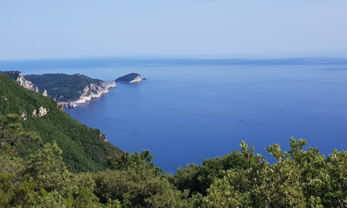
1. Palmaria Island hiking trail
- Hiking path 510 (loop trail around the island)
- The route: Terrizzo – Punta Carlo Alberto – CEA (Ostello Palmaria) – Crossroads with the “Path of the Condemned” ( 511) – Pozzale – Forte Umberto – Terrizzo
- Distance: 6 km (3.72 mi)
- Difficulty: Moderate
- Elevation: 280 mt (918.63 ft)
- Hiking time: approx. 3 hours
Tip: We recommend hiking counterclockwise (Terrizzo – Carlo Alberto – Pozzale). Learn more about Palmaria Island.
2. Portovenere – Campiglia hiking trail
- Hiking path AV5T
- The route: Portovenere – Sella Derbi – Bocca dei Cavalin – Campiglia
- Distance: 4.7 km (2.92 mi)
- Difficulty: Moderate
- Elevation: Ascent 450 mt (1476.38 ft) / Descent: 50 mt (164.04 ft)
- Hiking time: approx. 2 hrs 45 min from Portovenere to Campiglia and 2 hours from Campiglia to Portovenere
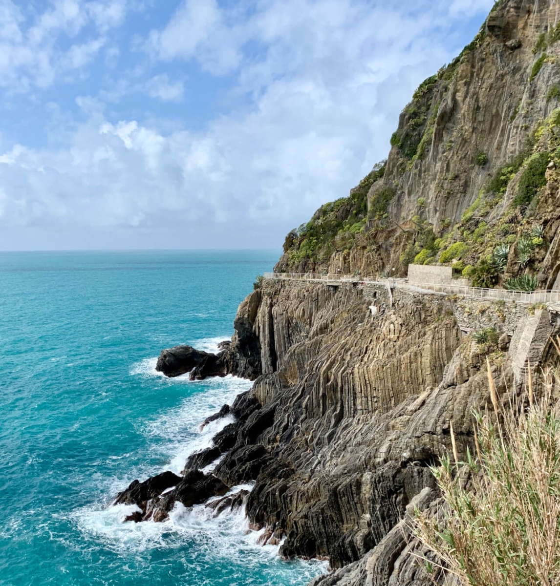
3. Telegrafo – Monterosso hiking trail
- Hiking path SVA
- The route: Colle del Telegrafo – Santuario di Montenero – Riomaggiore – Manarola – Corniglia – Vernazza – Monterosso
- Distance: 15.9 km (9.87 mi)
- Difficulty: Moderate
- Elevation: Ascent 460 mt (1509.19 ft) / Descent: 970 mt (3182.41 ft)
- Hiking time: approx. 6 hrs 30 min each way
Characteristics of the various sections within the SVA hiking route
A) Telegrafo – Riomaggiore
Distance: 4.8 km (2.98 mi)
Difficulty: Moderate
Elevation: Ascent 00 / Descent : 500 mt (1640.42 ft)
Hiking time: approx. 1 hr 45 min from Telegrafo to Riomaggiore and 2 hrs from Riomaggiore to Telegrafo
B) Riomaggiore – Manarola (Via Dell’Amore)
Distance: 1.3 km (0.80 mi)
Difficulty: Easy
Elevation: Ascent 20 mt (65,61 ft) / Descent : 20 mt (65,61 ft)
Hiking time: approx. 25 mins each way
*NOTE: This path is closed, its reopening is planned for summer 2024.
C) Manarola – Corniglia
Distance: 2.8 km (1.73 mi)
Difficulty: Moderate
Elevation: Ascent 120 mt (393.7 ft) / Descent : 30 mt (98.42 ft)
Hiking time: approx. 50 mins each way
*NOTE: This path is closed, the reopening date is still not known.
D) Corniglia – Vernazza
Distance: 3.2 km (1.98 mi)
Difficulty: Moderate
Elevation: Ascent 120 mt (393.7 ft) / Descent 220 mt (721.78 ft)
Hiking time: approx. 1 hr 35 mins each way
E) Vernazza – Monterosso
Distance: 3.8 km (2.36 mi)
Difficulty: Moderate
Elevation: Ascent 200 mt (656.1 ft) / Descent 200 mt (656.1 ft)
Hiking time: approx. 1 hr 50 mins each way
4. Vernazza – Monterosso hiking trail
- Hiking paths 508 – 582 – 591 – 509
- The route: Vernazza – Santuario di Reggio – Foce del Termine – Santuario di Soviore – Monterosso
- Distance: 9.1 km (5.65 mi)
- Difficulty: Moderate
- Elevation: Ascent 540 mt (1771.65 ft) / Descent: 540 mt (1771.65 ft)
- Hiking time: approx. 4 hrs from Vernazza to Monterosso and 3 hrs 45 mins from Monterosso to Vernazza
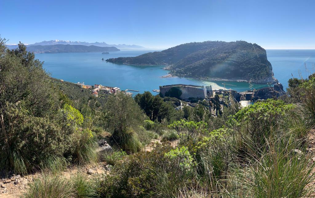
5. Anello Bonatti (Bonatti loop trail)
This hiking route was inaugurated in November 2021. It begins and ends in Portovenere, the resting place of the great mountaineer and explorer Walter Bonatti.
- Hiking paths AVG/AV5T, 516, 518, 517, 519
- The route: Piazza Bastreri – Castello Doria – Marble Quarry – Forte Muzzerone – Casa del Pastore – Piazza Bastreri
- Distance: 2.9 km (1.80 mi)
- Difficulty: Hard (for experienced hikers)
- Elevation: +330 mt (1082.68 ft)
- Hiking time: 90 minutes
BONUS TRAIL: Check out the lovely trail that takes you to the ancient Roman Villa of Varignano!
Some hiking tips
- Wear comfortable trekking shoes with a Vibram sole (running/sports shoes are not recommended) and bring sunscreen, a hat and enough water. A bug repellent might be helpful, depending on the season. Having a whistle that you can use to signal if needed is always a good idea.
- If you are hiking on your own, make sure to have a hiking map with you. It’s easy to get distracted by the beautiful views and miss the right turn!
- Consider hiking with an expert guide who can safely take you to the most hidden corners and tell you the stories only locals know!
- Avoid hiking when the paths are wet.
- Check that the trails are open before you head out. For more information on the Portovenere hiking trails, visit the website of Parco Naturale Porto Venere, while for the other areas, check out the Cinque Terre National Park. You can also find an updated map with all the hiking trails in La Spezia province curated by Club Alpino Italiano (CAI La Spezia).
Discover more from Discover Portovenere Blog
Subscribe to get the latest posts sent to your email.