Hiking is one of those amazing activities in nature that you cannot miss when visiting the Gulf of Poets and Cinque Terre, just like sailing or doing a boat tour. The paths between Monterosso, Manarola, Corniglia, Vernazza and Riomaggiore are particularly famous, but did you know that there are some wonderful hiking trails in Portovenere?
Hike from Portovenere to Cinque Terre (Riomaggiore)
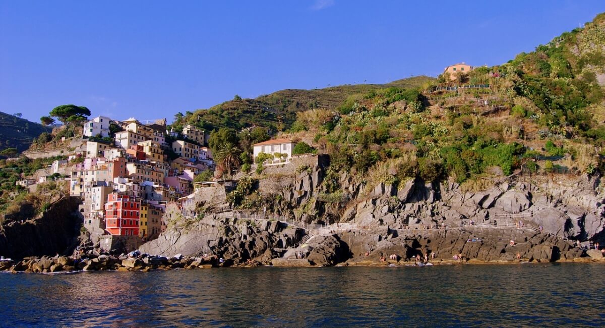
A spectacular 36-km long trail winds through the ridges of Cinque Terre, connecting Portovenere and Levanto. It is known as Alta Via delle Cinque Terre and it offers breath-taking views of the cliffs overlooking the sea, immersed in the scents of the Mediterranean scrub. The first stretch of itinerary is called Sentiero n.1 and goes from Portovenere to Colle del Telegrafo, from where you can descend in the village of Riomaggiore.
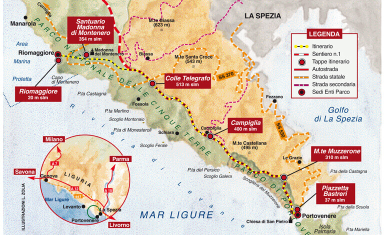
From Piazza Bastreri in Portovenere, you can take the trail that runs along the majestic Doria Castle and that leads you to Monte Muzzerone. This white limestone wall is 310 meters high and a popular spot for rock climbing. This is the first and most important obstacle to overcome on Sentiero n.1: the hiking trail is well marked but, considering the slope, requires a certain effort. However, you will be repaid by the view: nearby you can see the islands of Palmaria, Tino and Tinetto; the rugged and jagged Cinque Terre landscape and the Promontory of Punta Mesco. On the clearest days, you can even see Gorgona and Capraia, which are the northernmost islands of the Tuscan archipelago!
After a passage and a stretch of woods, you reach the village of Campiglia, at 400 meters above sea level. This small village is on the ridge that divides its panoramas between the sea of the Cinque Terre on one side and the Gulf of La Spezia on the other. The hiking trail then alternates pine and chestnut forests that occasionally thin out and give you wonderful views of the sea below, including the Ferale Cliff and the hamlet of Schiara.
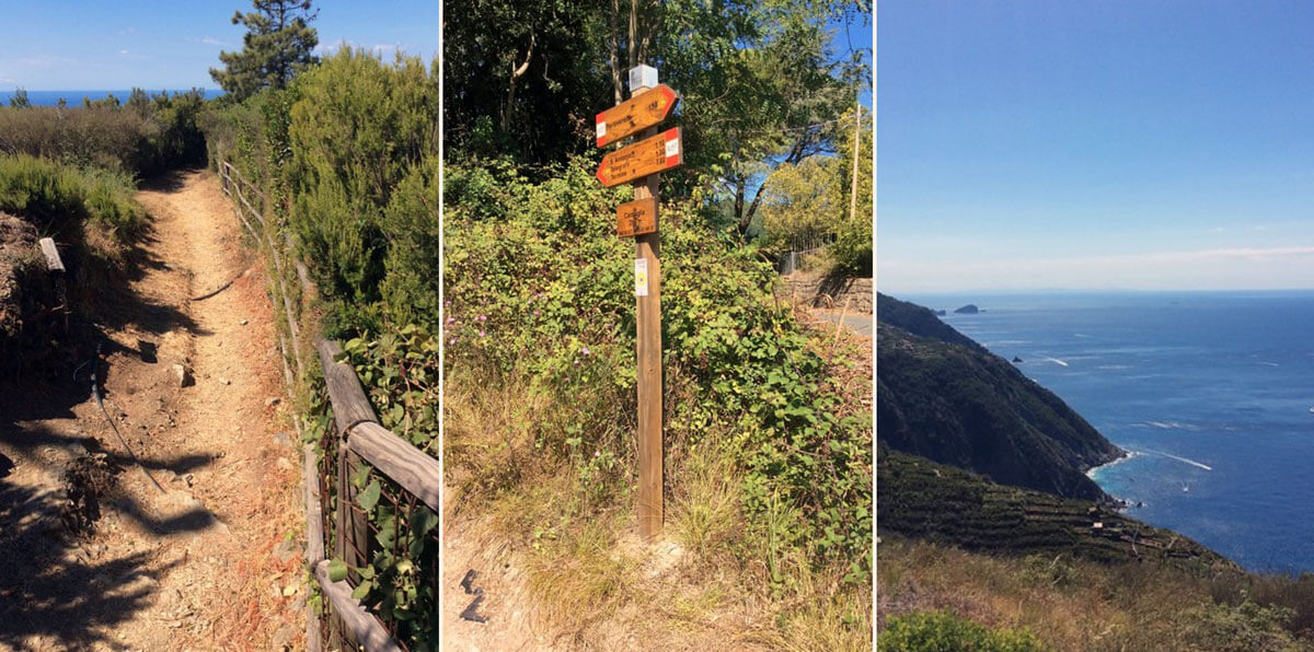
Along Sentiero n.1 you will notice how the landscape was affected by human action with the typical dry-stone terraces cultivated with vines, which are crossed by curious monorail vehicles that winemakers use to move along these steep slopes.
At 500 meters above sea level, the hiking route continues among beautiful cork oaks and then crosses the pine forest that houses the Palestra nel Verde (outdoor gym/sports area). With the last stretch in the scrub you reach Colle del Telegrafo (516 meters a.s.l.), from where you can enjoy a unique landscape on the Apuan Alps, the Carrara marble quarries and the green Val di Vara between Liguria and Tuscany. Leave the Alta Via hiking trail to take Sentiero n.3, that takes you down to Riomaggiore, the southernmost of the Cinque Terre villages. Along the way, you will find the Sanctuary of the Madonna di Montenero (354 meters a.s.l.) dating as far back as 1335.
Overall, this hiking trail between Portovenere and Riomaggiore is about 13 km long and needs around 5-6 hours to be completed. There is a difference in altitude of 550 meters, and although there are some steep slopes occasionally, Sentiero n.1 is accessible to all. You can hike it throughout the year, although in summer it is advisable to hike in the early morning or late afternoon to avoid the strong heat.
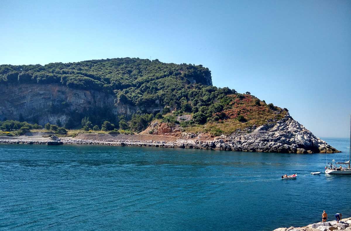
Hiking on Palmaria Island
Another fantastic hiking trail in Portovenere is the one on Palmaria Island, just across the sea channel. The island, which is an imposing limestone formation, can be visited with a hike of 4 or 5 hours. Its winding loop path takes you to ancient forts, the fragrant scrub and to spectacular cliffs and grottos, where fossil remains of Pleistocene animals and burial sites have been found. Read more on Palmaria Island here.
Near Portovenere: Hiking in the Val di Vara
If you are looking for an alternative hiking option, this green organic valley near the Gulf of La Spezia is ideal. The Val di Vara stretches inland from the Gulf of Poets and is crossed by the Vara River. Its upper countryside is also known as the “Valley of Organic Products” (Biodistretto Val di Vara – La Valle del Biologico) due to its 1200 hectares of fields and pastures that have obtained the BIO Certification, and more than 100 local businesses that have been certified for their organic and sustainable approach. Read more about the Val di Vara here.
Near Portovenere: Sentiero Verde Azzurro (Cinque Terre)
The ‘Sentiero Verde Azzurro’ is one of the most spectacular hiking trails in the Cinque Terre, connecting Monterosso and Corniglia. It was closed for about 6 years due to a landslide. In 2020, the hiking paths that go from Monterosso to Vernazza and from Vernazza to Corniglia were reopened to the public, following the reconstruction of dry-stone walls that had collapsed. For more information, contact ufficiosentieri@parconazionale5terre.it or visit www.parconazionale5terre.it.
The Cinque Terre National Park regularly publishes new maps of its 120km of hiking trails between Cinque Terre, Portovenere and Val di Vara. You can find them in the park’s Info Points.
Sources
Francesco Tomasinelli on rivistanatura.com
Parco Nazionale 5 Terre
Discover more from Discover Portovenere Blog
Subscribe to get the latest posts sent to your email.
2 Comments